The Flying Cameras
Twilight Productions
5708 Davies Ave
CSL, QC
Canada H4W 2R2
514-900-8426
Contact: info@theflyingcameras.com
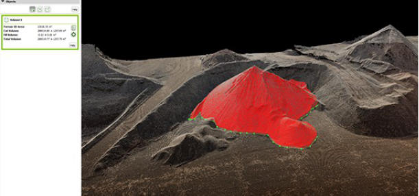
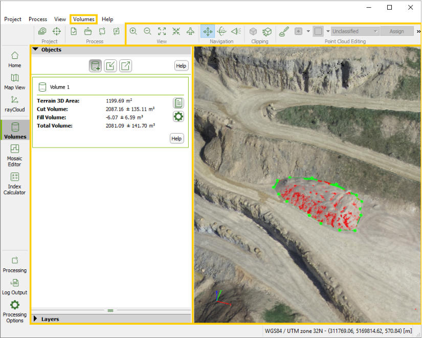
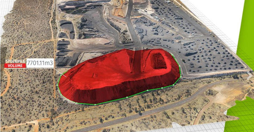
Volume Calculation
Output calculated volumes on a perfect representation of your
stockpiles, with fully-adjustable base height which leads to
precise measurements.
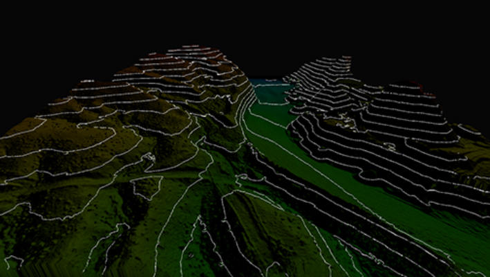
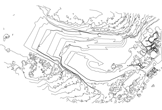
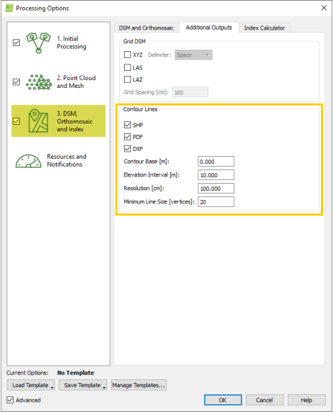
Contour Lines
Generate a simplified representation of topography with closed contours displaying the
elevation.
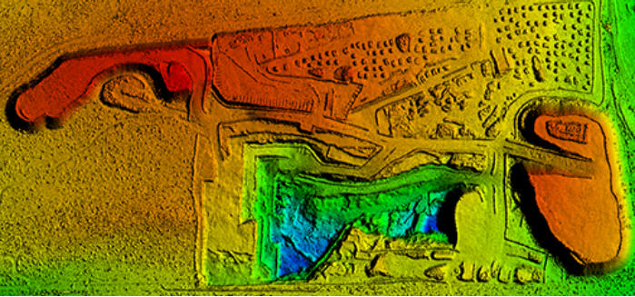
Digital Surface & Terrain Model
Digital models that give you the elevation value of each pixel, with or without above-ground
objects, ready for your preferred GIS workflow.
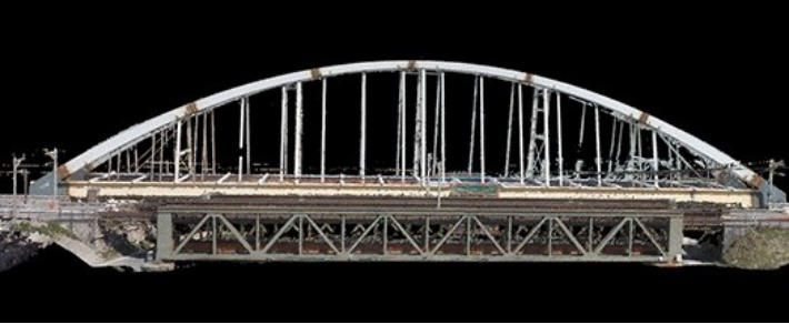
3D Point Cloud
More dense than laser-scanned points, the 3D point cloud derived from
overlapped images gives you the precise location of the reconstructed object
space.
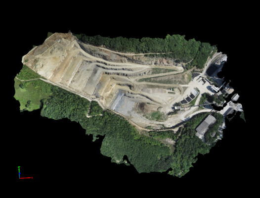
Orthomosaic
A high resolution map with each pixel of the original images correctly projected
onto the digital surface model, leaving you no perspective distortions but only
accurate geolocation.
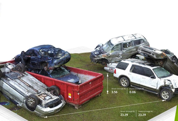
Precise measuring when the time factor is working against you.
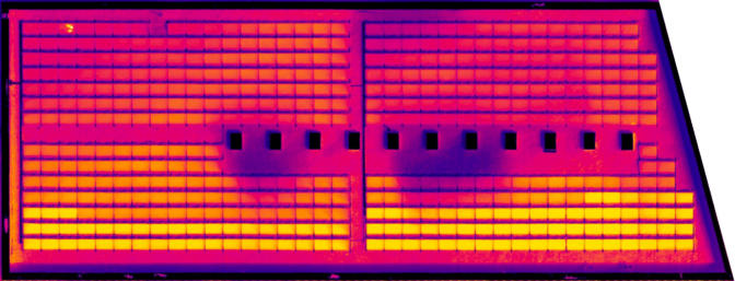
Thermography
A radiometrically-accurate map with a temperature value of each pixel
Phone: 514-488-0103
Executive in charge of productions is Marty Kattleman
Tech Supervisor ask for Rick.
PR and marketing ask for Richard.
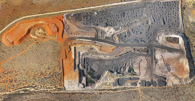
3d virtual rendering from an elevation of
150 feet.

3D mapping is an invaluable tool in many industries. Below are just some
of the services we can provide. See if any are suitable for you. Contact
one of our specialists at The Flying Cameras if you have any inquiries.
What an engineer in the field has to say about this technology:
Using 3D drone mapping has reduced a hazardous 2 week project of a 3 quarry site to a
simple 2 day drone shoot with no safety limitations. Cutting manpower resources is a great
cost reduction, and using drone technology is a lot more precise in measurements as many
more reference points are used.
Watch the two minute video at left.